Principal Investigator
:
Dr hab. Piotr Weckwerth
Nicolaus Copernicus University in Toruń
Panel: ST10
Funding scheme
: OPUS 16
announced on
14 September 2018
The main objective of the project is to identify, describe and analyse unequivocal evidence, hitherto unavailable in Europe, for extreme glacial events and, specifically, for sudden discharges of large quantities of meltwaters and surges in the periphery of the ice sheet during the last glaciation period. Our research thus far has allowed us to identify the landforms that suggest such extreme glacial events indeed took place and the processes involved in their evolution, which were previously unknown for the north-eastern Poland or in even southern periphery of the last Scandinavian ice sheet.
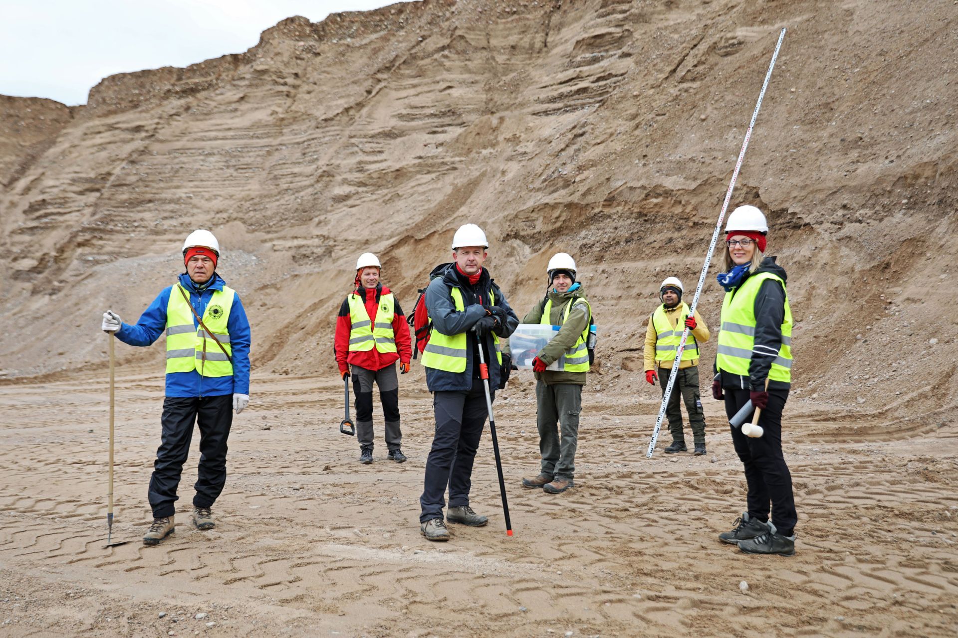 Field studies at the research station in Biała Woda, north of Suwałki (standing from the left: W. Wysota, A. Krawiec, P. Weckwerth (PI in an NCN grant), M. Chabowski, D. Kumar, E. Kalińska). Photo by Andrzej Romański
In our project, we reconstructed the processes that shaped such landforms and led to the deposition of sediments under the ice sheet and within the ice stream in the vicinity of the town of Rajgród. It was the first time that ribbed moraine landforms were identified in north-eastern Poland, represented by groups of parallel ridges orientated transverse to the ice flow, which were formed sub-glacially (under the ice sheet) as a result of the quick advance of the glacier, whose pressure deformed the bedrock. On the other hand, by identifying the morphology, geological structure and origins of landforms created by catastrophic glacial floods near Suwałki (north-eastern Poland), we were able to understand the processes by which such floods transported and deposited various sediments, their energy and flow regimes, as well as their flow parameters (depth, speed, hydraulic gradient, etc.).
Field studies at the research station in Biała Woda, north of Suwałki (standing from the left: W. Wysota, A. Krawiec, P. Weckwerth (PI in an NCN grant), M. Chabowski, D. Kumar, E. Kalińska). Photo by Andrzej Romański
In our project, we reconstructed the processes that shaped such landforms and led to the deposition of sediments under the ice sheet and within the ice stream in the vicinity of the town of Rajgród. It was the first time that ribbed moraine landforms were identified in north-eastern Poland, represented by groups of parallel ridges orientated transverse to the ice flow, which were formed sub-glacially (under the ice sheet) as a result of the quick advance of the glacier, whose pressure deformed the bedrock. On the other hand, by identifying the morphology, geological structure and origins of landforms created by catastrophic glacial floods near Suwałki (north-eastern Poland), we were able to understand the processes by which such floods transported and deposited various sediments, their energy and flow regimes, as well as their flow parameters (depth, speed, hydraulic gradient, etc.).
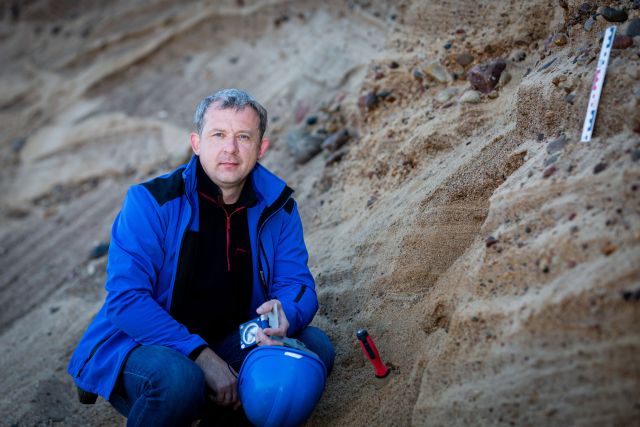
 Dr hab. Piotr Weckwerth, photo by Michał Łepecki
Studies conducted in the past few years within the framework of our NCN-funded project allowed us to identify a morphogenetic system of glacial floods in north-eastern Poland, which consists of two principal parts. One (subglacial) comprises a group of subglacial valleys, along with an extensive depression considered as the floodwater source. The other (proglacial) consists of two valleys that come together near the town of Suwałki and form a wide outwash plain further to the south. Our studies of sediments and the conditions of their deposition allowed us to identify, for the first time on the European lowland, landforms that suggest glacial flooding during the last glaciation, including bedforms such as transverse furrows, cyclic steps, scours and small-scale pendant bars and chute bars. One of the most characteristic landforms left behind by the glacial megafloods that have been identified during our research in the Suwałki region are the megadunes identified in the area of Lake Wigry and Lake Serwy. These landforms were studied to identify their morphologic types and estimate paleo-hydraulic parameters, determine the features of the sedimentary environment in different zones of the glacial floodway, the spatial and temporal variation in the deposition of different sediment types and their ages (OSL dating). Among our most important achievements was the identification of a potential source of the glacial floodwaters in the Suwałki region: a subglacial lake situated in Lithuania, where we identified its sediments lying under till layer correlated with the Pomeranian phase of the last glaciation. Having estimated the spatial extent of the lake, we were able to reconstruct water flows under subglacial conditions and in the forefield of the ice sheet. In order to model their dynamics, we used geoinformatics techniques and HEC-RAS software. Our simulations confirmed the location of the subglacial reservoir that served as the source of the glacial megafloods in question, caused by floodwaters flowing out of three different glacier gates (ice portals), and allowed us to calculate their flow hydrograms in the proglacial zone.
Dr hab. Piotr Weckwerth, photo by Michał Łepecki
Studies conducted in the past few years within the framework of our NCN-funded project allowed us to identify a morphogenetic system of glacial floods in north-eastern Poland, which consists of two principal parts. One (subglacial) comprises a group of subglacial valleys, along with an extensive depression considered as the floodwater source. The other (proglacial) consists of two valleys that come together near the town of Suwałki and form a wide outwash plain further to the south. Our studies of sediments and the conditions of their deposition allowed us to identify, for the first time on the European lowland, landforms that suggest glacial flooding during the last glaciation, including bedforms such as transverse furrows, cyclic steps, scours and small-scale pendant bars and chute bars. One of the most characteristic landforms left behind by the glacial megafloods that have been identified during our research in the Suwałki region are the megadunes identified in the area of Lake Wigry and Lake Serwy. These landforms were studied to identify their morphologic types and estimate paleo-hydraulic parameters, determine the features of the sedimentary environment in different zones of the glacial floodway, the spatial and temporal variation in the deposition of different sediment types and their ages (OSL dating). Among our most important achievements was the identification of a potential source of the glacial floodwaters in the Suwałki region: a subglacial lake situated in Lithuania, where we identified its sediments lying under till layer correlated with the Pomeranian phase of the last glaciation. Having estimated the spatial extent of the lake, we were able to reconstruct water flows under subglacial conditions and in the forefield of the ice sheet. In order to model their dynamics, we used geoinformatics techniques and HEC-RAS software. Our simulations confirmed the location of the subglacial reservoir that served as the source of the glacial megafloods in question, caused by floodwaters flowing out of three different glacier gates (ice portals), and allowed us to calculate their flow hydrograms in the proglacial zone.
Our geomorphological and sedimentological results have already been published in several JCR-listed journals, as well as in a chapter of a monograph published by Springer Nature. Data on the landforms, deposits and processes associated with glacial flows of up to 2 mln m3/s that we identified place our research among the best in the world and shed new light on glacial phenomena in north-eastern Poland and western Lithuania which, as it turns out, had a fundamental impact on the evolution of the valley system in the European Lowland. Our research has won numerous accolades, including a “GEOLOGIA 2021” Award in the “Research record/Fundamental discovery” category of a competition organised by the Ministry of Climate and Environment.
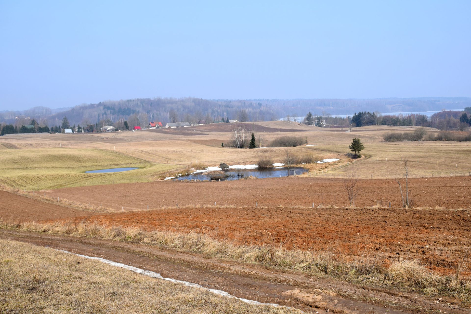 Ice sheet meltwater discharge area near Bachanów, photo Piotr Weckwerth
Project title: Geomorphic records and palaeogeographic implications of Late Weichselian glacial megafloods and surges at the southern sector of the Scandinavian ice sheet (MEASSIS)
Dr hab. Piotr Weckwerth
(born 1971) geomorphologist and geographer. His research centres on the glacial and fluvial geomorphology of the European Lowland and currently glaciated regions. He is particularly interested in glacial floods, fluvial sedimentology, the evolution of glacial landforms and Europe’s system of valleys, as well as in estimating past river flows in the process of palaeographic and paleoenvironmental reconstruction.